Land Survey for your Cottage or Waterfront Property
You Are Here: Buy a Cottage> Land SurveyAre you wondering why you need to have a survey?
Now these old time survey crews chopped and hacked their way through the underbrush dragging chains for measuring. Each chain was 66 feet long, a mile was 80 chains and the measurement is described as metes and bounds.
Many of today's waterfront lots were divided and then handed down by their parents to the next generation and so on.
Now when they are sold to new property owners, many of these lots have never been surveyed since the original crews.

Family giving lots to family for friendly neighbors it wasn't as much of a concern even 30 years ago.
Prices were not like they are today!
Even today when separate land survey crews go in they can end up with different findings.
Over the years many cottage properties had improvements where the owners did not worry about or the actual property lines, many probably assumed it was their land.
Cottages have been built and expanded without permits; some have encroached on Crown land.
Others have been expanded to the point the septic system is not adequate and needs to be replaced.
Problem is there may be insufficient land on the cottage lot or the soil conditions do will not allow a new system to be installed.
A Land Survey for cottage and waterfront properties, as well as other lands in Ontario, are described in an exact manor so you cannot mistake one property with another.
A survey contains four essential components; Research, measurement, monumentation and the Plan or Report.

If a property needs a new survey, surveyors determine the boundary lines of a property based on the best evidence available.
The boundary lines will not necessarily be based on an earlier survey or description in the deed, in other words they may end up not where you thought!
The surveyor will establish the best evidence considering the priority and weight of the evidence. Based on the courts, by order of importance:
- Rivers- or natural boundaries bordering the property
- The original monuments set on the land
- Physical evidence on ground takes precedence over written description in the transfer/ deed, so what your deed says may not end up being what you own!
Any forms provided that does not contain a seal may have incorrect information added on without the knowledge of the originally issuing surveyor.
When buying a cottage, a waterfront home, a cabin or any recreational property you should consider having a 'Surveyors Real Property Report' completed.
Also described as a 'Building Location Survey' this will have two parts: The Plan of Survey and the Certification.
For you as the purchaser, it will show the buildings, driveways, and outbuildings,everything that might affect your enjoyment the property.
An up to date real property report should be obtained before closing to ensure there are no major discrepancies over the property, structure and building borders.
Last thing:If you see the wording an up to date survey, use caution because the only true up to date survey is one that has just been done.
Due diligence on the property is important. Be Careful.
Cottages for Sale - Back to Home Page

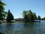
BIG RIDEAU LAKE
3276 MacDonald Island Road
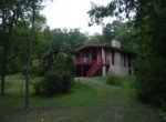
1473 North Shore Road Kingston

BUYER PROGRAM